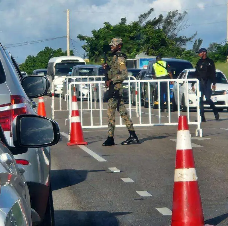
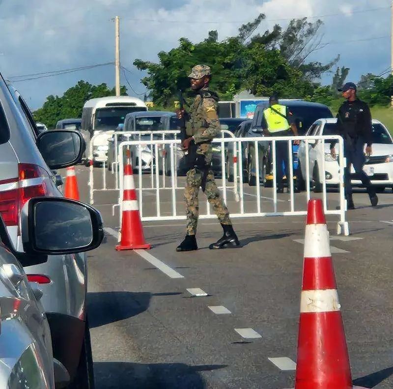
JAMAICA: State of Public Emergency declared in four more police divisions
 23 January 2025


SOURCE: JAMAICA OBSERVER- A State of Public Emergency (SOE) has been declared for four more police divisions namely St Andrew South, St Andrew Central, Kingston Western, and St Catherine South following an uptick in violent crime.
Police say increasing incidences of gang-related warfare posing a public safety risk to residents, commuters and bystanders fueled the decision.
The SOE provides enhanced security tactics which the government hopes will enable security forces to “disrupt criminal networks, apprehend offenders, and foster conditions for lasting peace”.
The boundaries of the State of Public Emergency in the St Andrew South Police Division are defined as follows:
East: Starting at the foot of Red Hills at the intersection of Perkins Boulevard, Molynes Road and Red Hills Road, extending in a south-south-easterly direction along Molynes Road then onto Seaward Drive, Mimosa Road, Aloe Ave, Bay Farm Road, Newark Avenue, Elm Crescent, Keesing Avenue, Hagley Park Road, Omara Road, and Chisolm. Avenue to the point of intersection with Maxfield Avenue;
South: Extending in a south-westerly direction from the intersection of Chisolm Avenue and Maxfield Avenue, along Maxfield Avenue onto East Avenue to the coastline in the vicinity of Petrojam and extending along the said coastline in the vicinity of the Kingston Container Terminal to the Portmore Causeway Bridge;
West: Continuing in a north-westerly direction from the Portmore Causeway Bridge along the Fresh River and the shared parish border of St Andrew and St Catherine to the west of Riverton, and extending to the vicinity of the westernmost end of the Belvedere to Ferry secondary road; and
North: Extending in an easterly direction along the Belvedere to Ferry Road to the foot of Red Hills at the intersection of Perkins Boulevard, Molynes Road and Red Hills Road, the start point.

The boundaries of the State of Public Emergency in the St Andrew Central Police Division are:
East: Starting at point southeast of the Derby Peak in Constitution Hill, trending along an imaginary line in a South-easterly direction to the bridge across the Cane River in the community of Bito;
South: Extending in a north-westerly direction from the bridge across the Cane River in the community of Bito along an imaginary line that trends across the Dallas Mountains to the bridge in August Town that spans the small gulley way leading to the Hope River, along an imaginary line that trends across the Long Mountain to the intersection of Deanery Road and Mountain View Avenue, along Diana Drive leading to Vineyard Road, onto Camp Road leading to Dames Drive and Connolly Avenue, then leading to Heroes Circle and next onto Slipe Road, west along Studio One Boulevard, next along Lyndhurst Road leading to the intersection with Rousseau Road, lastly along Rousseau Road leading to intersection with Maxfield Avenue;
West: Continuing in a north-westerly direction along Maxfield Avenue from the intersection with Rousseau Road then northwest along Chisolm Avenue to the intersection. With Omara Road, North west along Omara Road to the intersection with Hagley Park Road, then Southwest along Hagley Park Road to the intersection with Keesing Avenue, northwest along Keesing Avenue (which includes a section of Elm Crescent) to the intersection with Waltham Park Road, northeast along Waltham Park Road then west onto Bay Farm Road, northeast along Aloe Avenue to the intersection with Mimosa Road, then west along Mimosa Road to Seaward Drive leading to Molynes Road, then north along Molynes Road to the intersection with Washington Boulevard; and
North: Extending in an easterly direction along Washington Boulevard to the intersection with East Kings House Road, then north-easterly leading to Barbican Road, along Jacks Hill Road to the intersection with Sunset Avenue, then along an imaginary line trending easterly to Skyline Drive to the intersection with the Gordon Town main road then along an imaginary line trending easterly and terminating at point southeast of the Derby Peak in Constitution Hill.
The boundaries of the State of Public Emergency in the Kingston Western Police Division are defined as follows:
North: The northern boundary will start at the intersection of Maxfield Avenue and Rousseau Road and then extend in an easterly direction to the intersection of Rousseau Road and Lyndhurst Road. The boundary will then continue in a southeasterly direction along Lyndhurst Road, then Brentford Road to its intersection with Slipe Road;
East: The eastern boundary continues in a southerly direction along Slipe Road, Orange Street, North Street and then onto Princess Street. The boundary continues south along Princess Street, then onto West Queen Street, West Street, Harbour Street, Pechon Street and then Ocean Boulevard, to the coast;
South: The southern boundary extends westerly along the coast of Kingston to the vicinity of East Avenue; and
West: The western boundary continues in a north-easterly direction across Marcus Garvey Drive onto East Avenue and then Maxfield Avenue to the starting point.
The boundaries of the State of Public Emergency in the St Catherine South Police Division are defined as follows:
East: Starting at Rock Hall and extending south-easterly along the common boundary between the parishes of St Catherine and St Andrew to the coast in the vicinity of the Kingston Container Terminal;
South: Thence generally westerly along the territorial coastline limits of St Catherine to the common boundary between the parishes of St Catherine and Clarendon in the vicinity of the Port Esquivel Airstrip;
West: Continuing in a northerly direction along the common boundary between the parishes of St Catherine and Clarendon to where the communities of Old Harbour, Rock River and Bellas Gate meet; and
North: Thence generally south-easterly for approximately 19 kilometers at a bearing of
approximately 127 degrees to the PJ Patterson Highway. Thence extending southerly for approximately five kilometres to where the communities of Cromarty, Bushy Park and Old Harbour Road meet. Continuing generally in a north-easterly direction for approximately 33 kilometres at a bearing of approximately 40 degrees back to the starting point.
The Government and the security forces say they will continue to take all necessary actions to protect the safety of residents and restore normalcy.
CLICK HERE TO JOIN OUR WHAT’S APP GROUP
CLICK HERE TO JOIN OUR WHAT’S APP GROUP
CLICK HERE TO JOIN OUR WHAT’S APP GROUP
CLICK HERE TO JOIN OUR WHAT’S APP GROUP
CLICK HERE TO JOIN OUR WHAT’S APP GROUP
CLICK HERE TO JOIN OUR WHAT’S APP GROUP
CLICK HERE TO JOIN OUR WHAT’S APP GROUP
CLICK HERE TO JOIN OUR WHAT’S APP GROUP
CLICK HERE TO JOIN OUR WHAT’S APP GROUP
CLICK HERE TO JOIN OUR WHAT’S APP GROUP
CLICK HERE TO JOIN OUR WHAT’S APP GROUP
CLICK HERE TO JOIN OUR WHAT’S APP GROUP
Advertise with the mоѕt vіѕіtеd nеwѕ ѕіtе іn Antigua!
We offer fully customizable and flexible digital marketing packages.
Contact us at [email protected]
Related News

Temporary ID cards are now being issued at the Precision Centre.

Harvard University Officials Pledge Support for Reparative Research and Healthcare in Anti...

Governor General Commends Wehner’s Role in Strengthening Democracy


